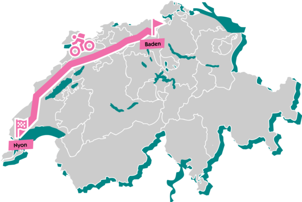
As in previous years, the journey begins in the traditional spa town of Baden, idyllically situated at the foot of the last foothills of the Jura mountain range, the “Lägern.” From there, the route first leads through the Limmat Valley before gaining noticeable altitude for the first time at Brugg. The route through the canton of Aargau is characterized by varied terrain: challenging climbs, rapid descents, and ever-changing landscapes.
After crossing the Salhöhe, a particularly charming part of the route begins: the interplay along the cantonal border between Baselland and Solothurn. The village of Balsthal is the last major civilized point for quite some time – after that, it becomes noticeably quieter and more natural. Contrary to most expectations, this first part is the most challenging for many participants. The constant ups and downs and the sometimes steep climbs are tough going.
This makes the new and easy-going section of the route from Gänsbrunnen all the more welcome. Via Moutier (the Bernese village that will belong to the canton of Jura from January 1, 2026), the route leads into the Val de Tavannes, past the world-famous “Tête de Moine cheese dairy,” through valleys and over mountain ranges to Courtelary, home of the popular Camille Bloch chocolate. A long climb finally leads to the Chasseral ridge, the highest point of the GTJ. At 1,606 meters above sea level, you can enjoy a breathtaking 360° panorama. To the north, the view stretches back to the typical forest pastures of the Jura and Switzerland’s largest wind farm, located between Mont-Crosin and Mont-Soleil. On the south side, you can admire the beauty of the three lakes (Biel, Neuchâtel, and Murten).
The route continues over the Col de la Vue des Alpes towards Couvet to the Creux du Van. A huge rock arena with a diameter of more than one kilometer! It was formed over millions of years by the erosion of water and ice. Imposing vertical rock faces over 160 meters high surround a deep valley basin. With a little luck, you may even spot ibex and chamois!
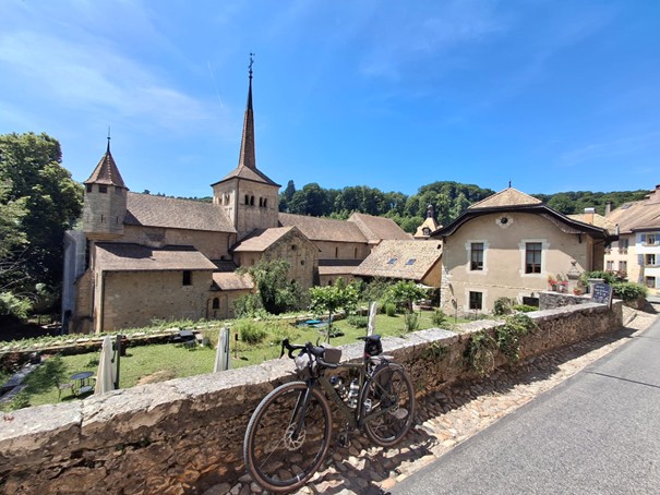
High above Lake Neuchâtel, you reach the canton of Vaud, the last of a total of seven cantons, and Sainte-Croix, one of the last large villages, at 1,100 meters above sea level. The trail continues across a high plateau typical of the Jura to the charming village of Romainmôtier. Nestled between two wooded hills on the Nozon River, it is also home to one of the oldest monasteries in Switzerland.
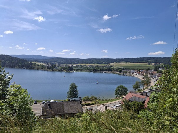
Not far from there is Lac de Joux. The largest lake in the entire Jura massif offers welcome refreshment in fine weather, and the numerous hotels and restaurants invite you to linger.
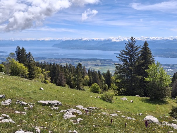
On picturesque forest and meadow paths, the route crosses the typical Jura forest pastures and climbs steadily to the Col de Marchairuz. Shortly after Saint-Cergue, the final ascent to La Barillette (≈ 1,528 m) begins, which is steep and technically challenging in places. The reward for your efforts is an impressive panoramic view over Lake Geneva to Mont Blanc. Now all that remains is to enjoy the long descent to Nyon and reflect on your achievement. You’re almost there. All your efforts will melt away, giving way to a deep sense of peace and unbridled pride!